Trail Walking Gemeinde Steeg - A finir - Photo
 dboon
dboon

User

© OpenStreetMap contributors
Length
Length
10.9 km
Max alt
Max alt
1886 m
Uphill gradient
Uphill gradient
556 m
Km-Effort
Km-Effort  
18.3 km
Min alt
Min alt
1504 m
Downhill gradient
Downhill gradient
564 m
Boucle
Boucle
Yes
Creation date :
2023-06-21 05:38:42.0
Updated on :
2023-06-28 11:48:05.772

(0 Reviews)

Walking
Walking
5h18
Difficulty : Difficult

Scan this QR Code to open this trail in the SityTrail application

FREE GPS app for hiking

Logo SityTrail SityTrail

IGN / Geographical institutes

Download SityTrail from the App Store Download SityTrail from Google Play

Logo SityTrail SityTrail World

The world is yours!

Download SityTrail from the App Store Download SityTrail from Google Play Download SityTrail on Huawei AppGallery

About

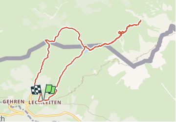
Trail Walking of 10.9 km to be discovered at Tyrol, Bezirk Reutte, Gemeinde Steeg. This trail is proposed by dboon.

Description

Belle boucle avec de magnifiques point de vue. Une tentative d'aller à l'auberge du "Rappensee. Le vertige m'a fait renoncer, mais le reste est "supportable" !

Elevation profile

Photos

Positioning

Country:
Austria
Region :
Tyrol
Department/Province :
Bezirk Reutte
Municipality :
Gemeinde Steeg
Location:
Unknown
Start:(UTM)
590830 ; 5235043 (32T) N.

Trails nearby

Trail Snowshoes Gemeinde Steeg - Autriche - Prenten - LärchspitzGipfel - Photo
Snowshoes
michel.heusschen@skynet.be

Snowshoes

Medium
Gemeinde Steeg, Tyrol, Bezirk Reutte, Austria
4.6 km | 13.6 km-effort
3h 0min
No
Trail Walking Gemeinde Steeg - bergfextour_warth--gehrner-berg--schrofenpass--gehren - Photo
Walking
dboon

Walking

Difficult
Gemeinde Steeg, Tyrol, Bezirk Reutte, Austria
7.2 km | 13.8 km-effort
3h 8min
Yes
Trail Walking Gemeinde Steeg - Ring from the
Walking
dboon

Walking

Medium
Gemeinde Steeg, Tyrol, Bezirk Reutte, Austria
6.3 km | 9.3 km-effort
2h 6min
Yes


Close
My subscriptions